Skip's handy list of various links relating the the Athens Olympic Whitewater Course.
Athens Whitewater Course Technical Specs (PDF).
ICF photo gallery of whitewater course.
Jacobi/Taylor photo tour of Athens WW Course.
Jacobi/Taylor (US C2 Team) Web Site.
Fund raising web site for Jacobi/Taylor.
Davey Hearn's web site.
New York Times Article.
NBC Olympics Canoe/Kayak Web Site.
NBC Olympics-Inside the sport page.
NBC Commentator article claiming whitewater and flatwater paddlers have little
in common. (Well... I thought it was funny...)
Hydrostatium company website (designer of Athens & Sydney courses).
Manufacturers film of artifical obstacles (MPEG).
[large] image of departure pool & pumps.
Video of course with water (22.1MB Media-Player).
Video of course (dry) showing obstaclies (5.8MB Media-Player).
Diagram of Peking Olympic Whitewater Course
International Canoe Federation site.
Canoe/Kayak Magazine Web Site.
Diagrams & pictures of Athens Olympic Whitewater Course
(all found on the web, some edited).
All of these pictures were taken from other web sites (all from
the above referenced links). I put these together as I spent a long couple
evenings trying to find info on this course. Once I tracked the info down
I edited the photos by adding in the lines and notes using PaintShopPro.
I figured I'd make it much easier
for other paddlers who were also interested to learn about the course.
Of course I had a lot of fun actually figuring out what parts were what on the
course. Matching names of rapids to the few pictures (and the limited TV
coverage) was a challange. You'd figure that one of the few sports to sell
out at the Olympics would at least get more complete coverage. (But at least
I got it on tape.)
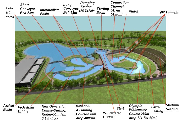
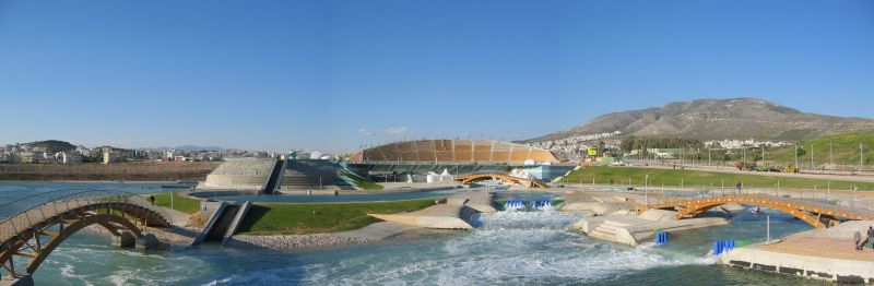
Course Features
The first diagram is based upon a picture I found in
the ICF Photo Gallery which I then modified by adding text and pointers to all
the features. If anything is wrong or left out please send
me (Skip Morris) corrections, thanks.
(Note: One thing I'm not exactly sure of is the course steepness,
measured as a drop in feet per mile.
Most references make me believe it is 111 ft/mile. However I found one
place that seemed to indicate the drop as being 131 ft/mile.)
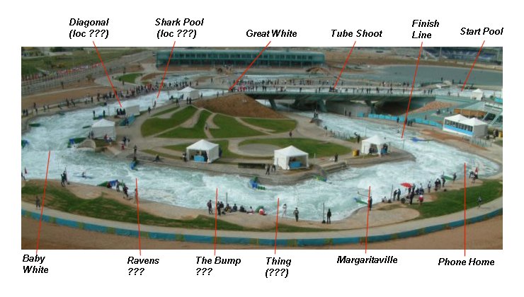
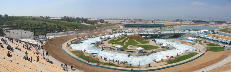
Identification of Major Drops
The below picture I edited by added the names of various drops as best
as I could figure
out which-was-which. Again, send me corrections if you get better info.
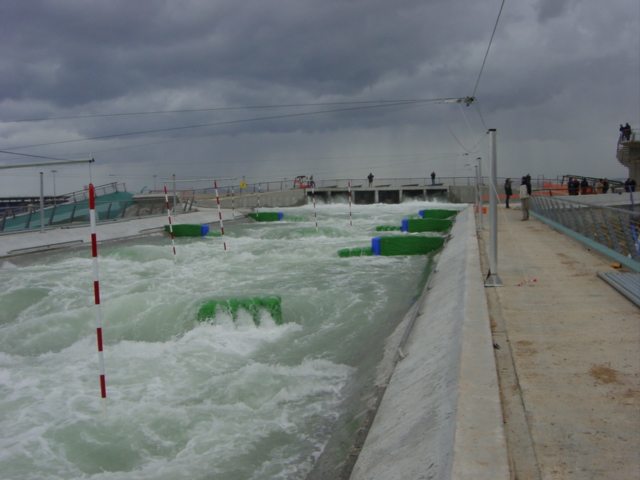
The features all apparently have official numbers which are
found in one of the video clips. The next step is to convert the video of
some of the runs into MPEG files and add them. Note: The water is so white
because the course uses salt water. The name "Maragaritaville"
came about because paddlers end up with a mouthfull of salt water at that
drop.
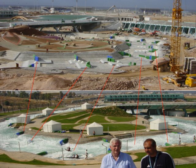
Creating the Drops
The next image was created from two shots I
found taken from the stadium steps, the
first one with course dry so you can see which riverbed features create
each of the rapids, waves and holes. Second shot was taken a little further
to the right. I've linked both pictures with lines showing what I believe
are the same points. The rapid directly between the heads of the two men in
the photo is Maragaritaville. (Note the pictures came from different sources
and were taken at different times, there are some differences between the courses
in the two shots, but they are the closest I could find.)
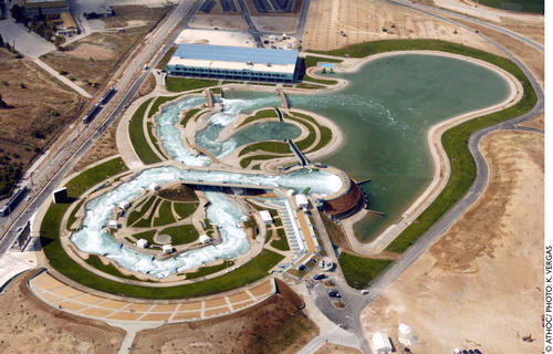
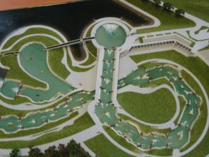
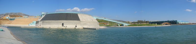
Two arial views (the one of the right a model).
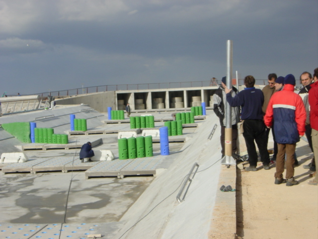
Four shots of Tube Shoot Rapid (one showing course dry).
This shot is almost the same view. Note the concrete slabs that can be
moved. The green and blue obstacles fit into the slabs and can likewise
be adjusted easily by one person.
These next two shots are of the finish line area. The second shot was
apparently taken at a higher water level since the obstruction in the center
of the channel becomes a wave. (It's also possible they were adjusting the
riverbed and changed/moved some features.)
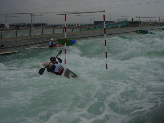
My only complaint about this work of art is the use of a Training Paddle,
as we all know Real Paddlers only need one blade... :-)
View of Next Generation (Surfing/Rodeo) Course and Conveyor Belts from
across the Arrival Basin.
View of Pumping Station and the lake.
This page has been viewed
 times.