Hurricane Irene in September 2011 changed many rivers in
New England as well as damaging roads, bridges, and dams. The
bridge over the East Branch of the Pemigewasset into Loon Mountain
Ski Area was heavily damanged with the river-right bridge abutment
being undermined and part of the bridge collapsing into the river.
|
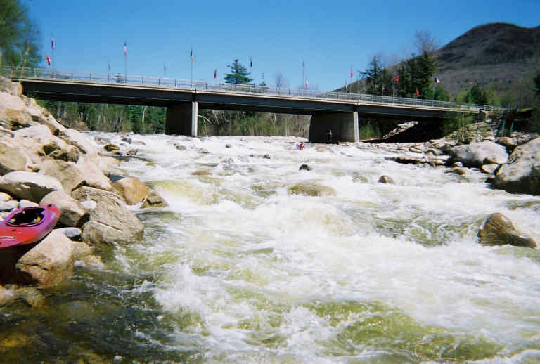
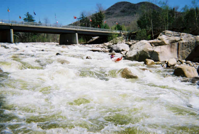
| 1. Loon Mountain Rapid on May 6, 2001. Level about 1000cfs. Photo taken by a paddling partner using a disposable camera. I'm paddling the center route of the main drop. The left channel was considered the "sneak" route; the center route a sporty IV+ run followed by a run down the left edge of the right channel. You start left-of-center, drive right as you pass over the lip of the drop; half-way bounce of a wave reflecting off a rock which throws you to the left and then into the flatter area along the base of the drop. If you were quick you could eddy-out on the left above the big rock then ferry across the bottom of the main drop to the center or river-right sides of the channel, (All of which provided fun and challenging runs down.) In higher water a right-edge route down the main drop appeared as well where you built up a lot of speed down a straight-but-exciting run down. |

| 2. View of the main drop from river-left just below the old bridge. Photo May 17, 2006. River level 1300 cfs (notice almost all the rocks in the main drop are covered). The boater is going down the left channel (considered the more conservative route). However at this level no route was really easy. On the left there were no must-make moves; but there was a few waves and holes to punch. |
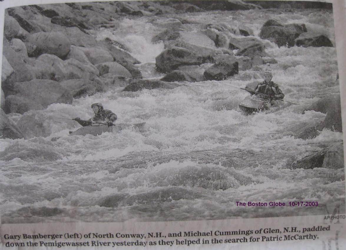
| 3. I believe this is the right edge of the right channel just below the main drop. These boaters are part of a group organized by Mark Lacroix to assist in the search for a missing 10-year-old boy on Oct 16, 2003. Level in the photo was ~800 cfs. Photo ©AP. I'm guessing the photographer was on the extreme far [left] side of the river using a very long lens. I had just taken out at the bridge as I'd punched a hole in my boat on the rocks. |
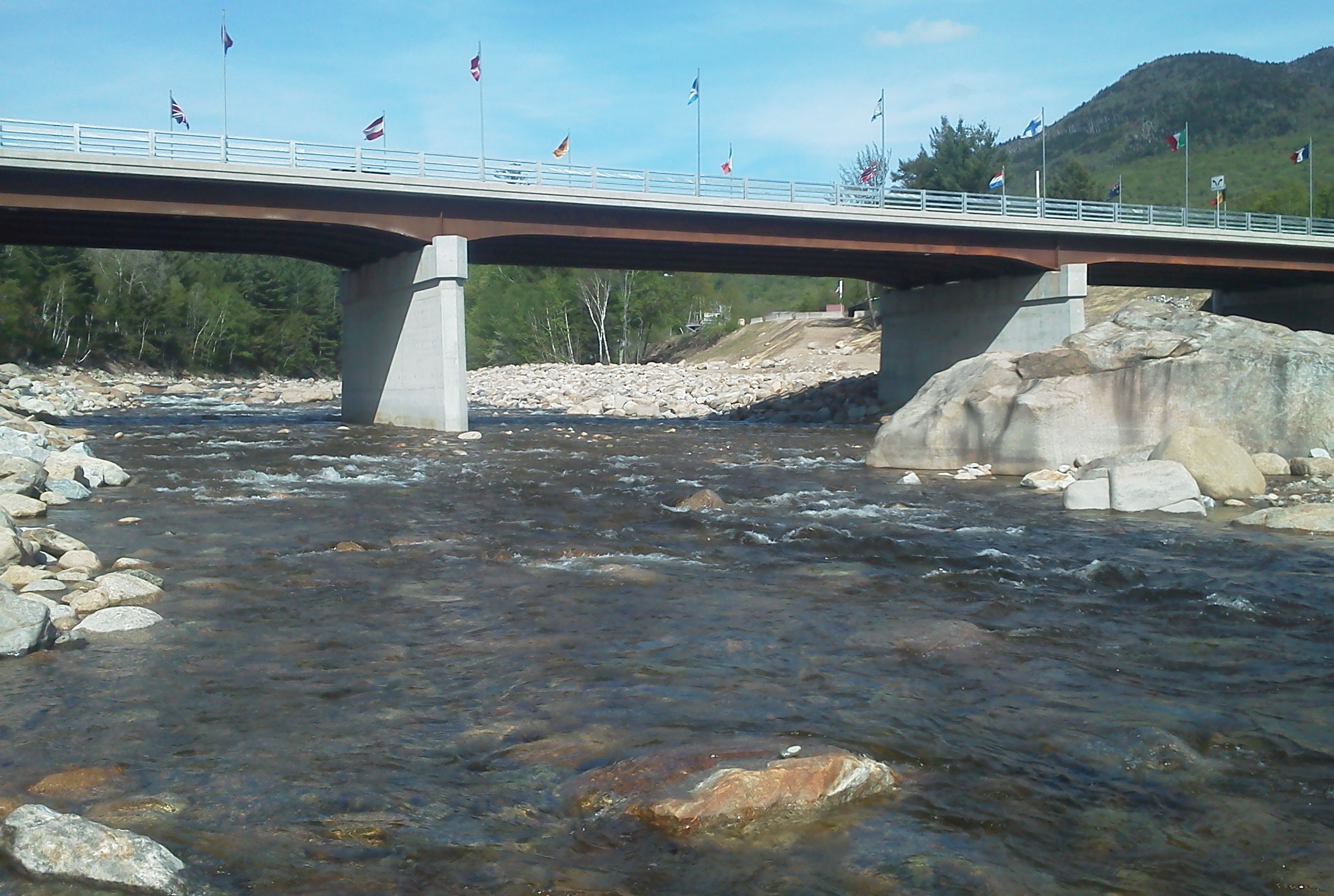
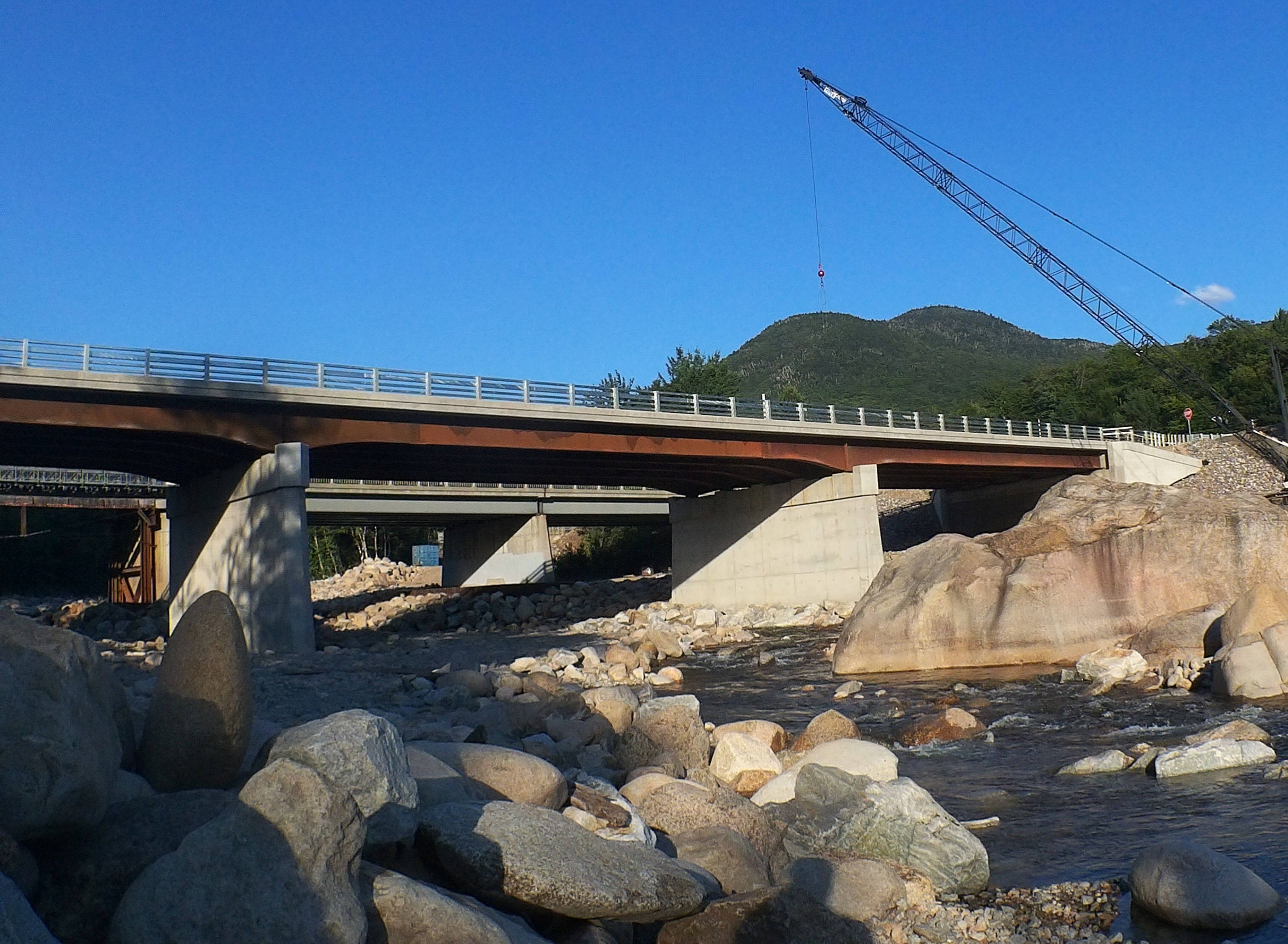
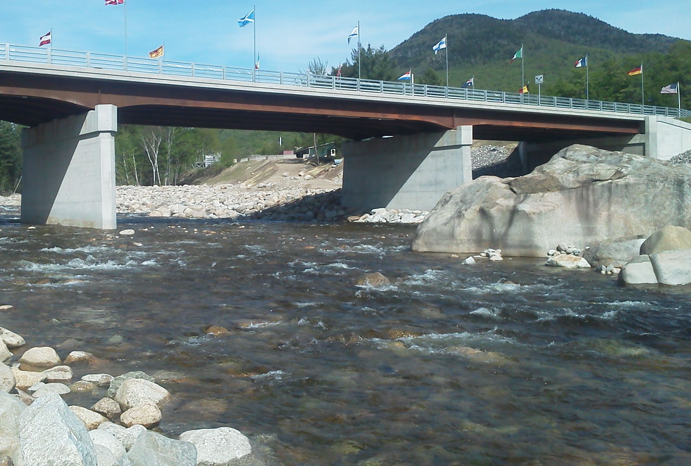
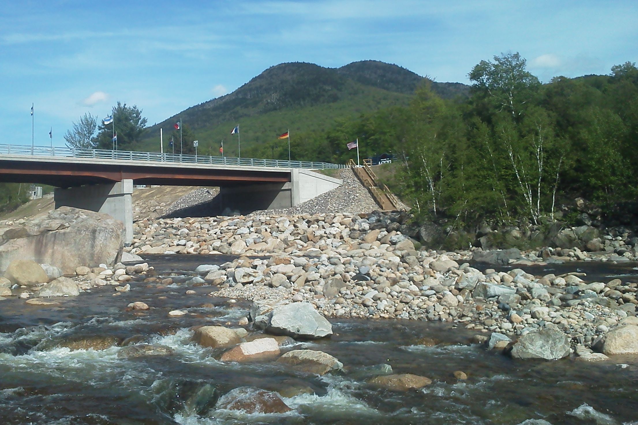
| 4. Project complete (photo taken May 23, 2017, level 480cfs), the new bridge sits on top of what was the main drop. The gradient has been completely flattened across the entire river. The rapid immediately upstream of the bridge is now slightly longer with a increased vertical drop at the end. Below the bridge the "smaller" huge rocks above the biggest house-sized rock in the center are gone. |
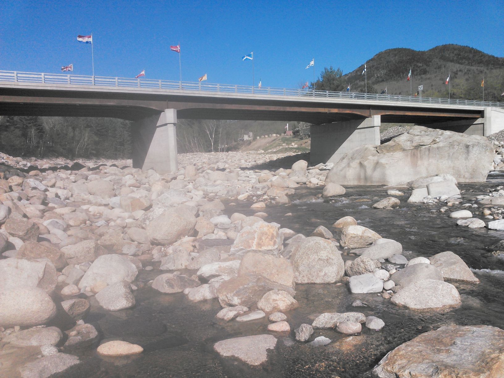
| 4a. A year later (photo taken May 12, 2018, level 600 cfs), the entire left channel is blocked with rocks. They most likely were placed there during spring hi-water events. The previous two-and-a-half weeks showed five different high-water events, four in the 3000–3500 cfs range, and one a week prior in excess of 7000 cfs after which the gage went offline for several days. |
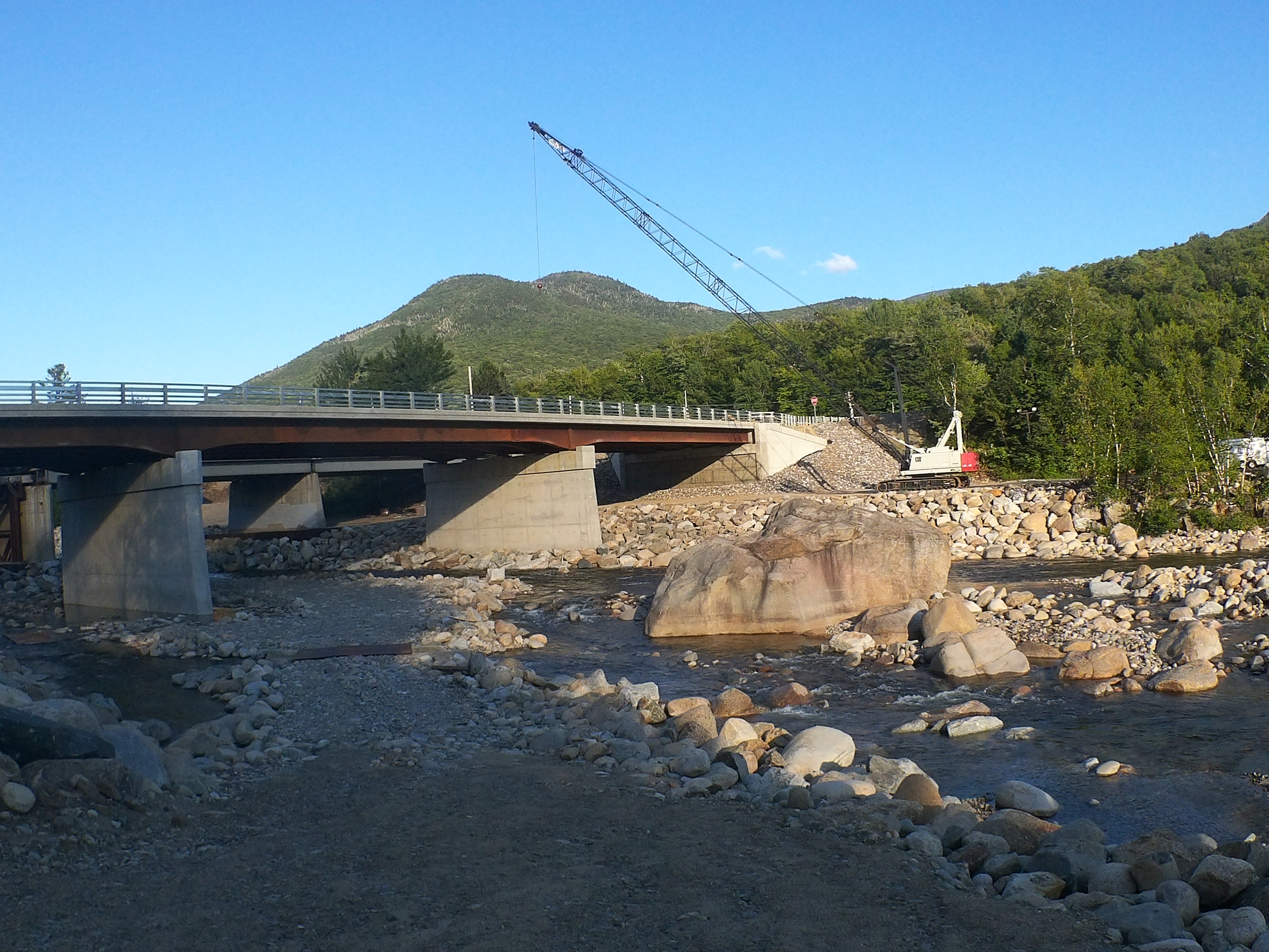
| 5. During construction (in 2013–2015?) a road was built down to, and across the river to support heavy machinery, completely blocking the right channel. Both the new bridge (downstream), and the original bridge (in the background) are visible. Photo July 7, 2016. |
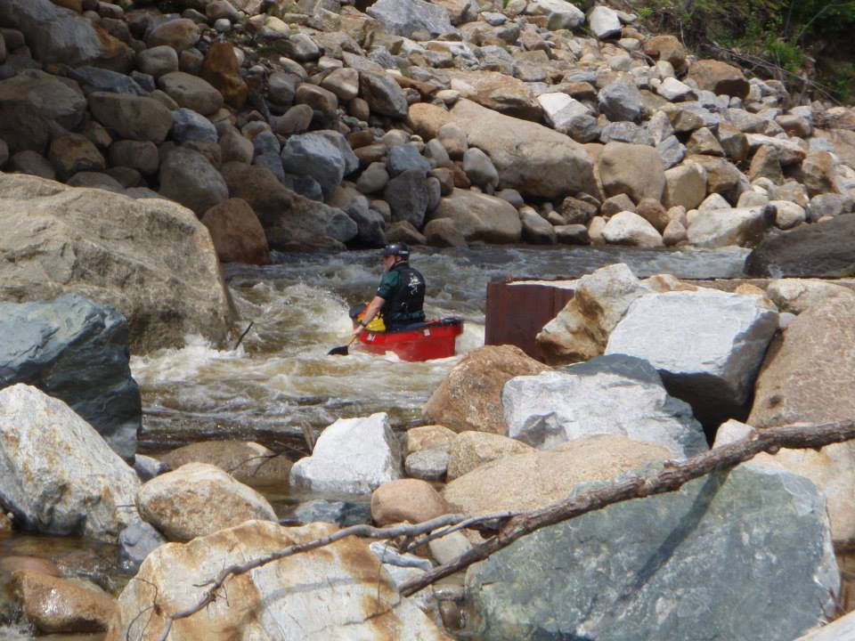
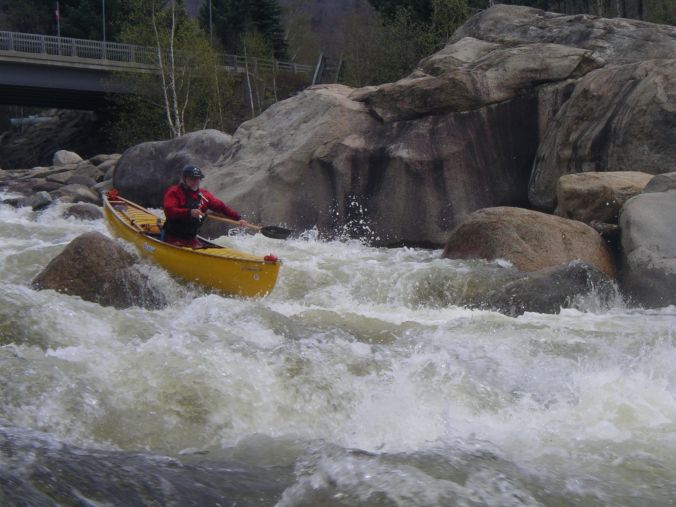
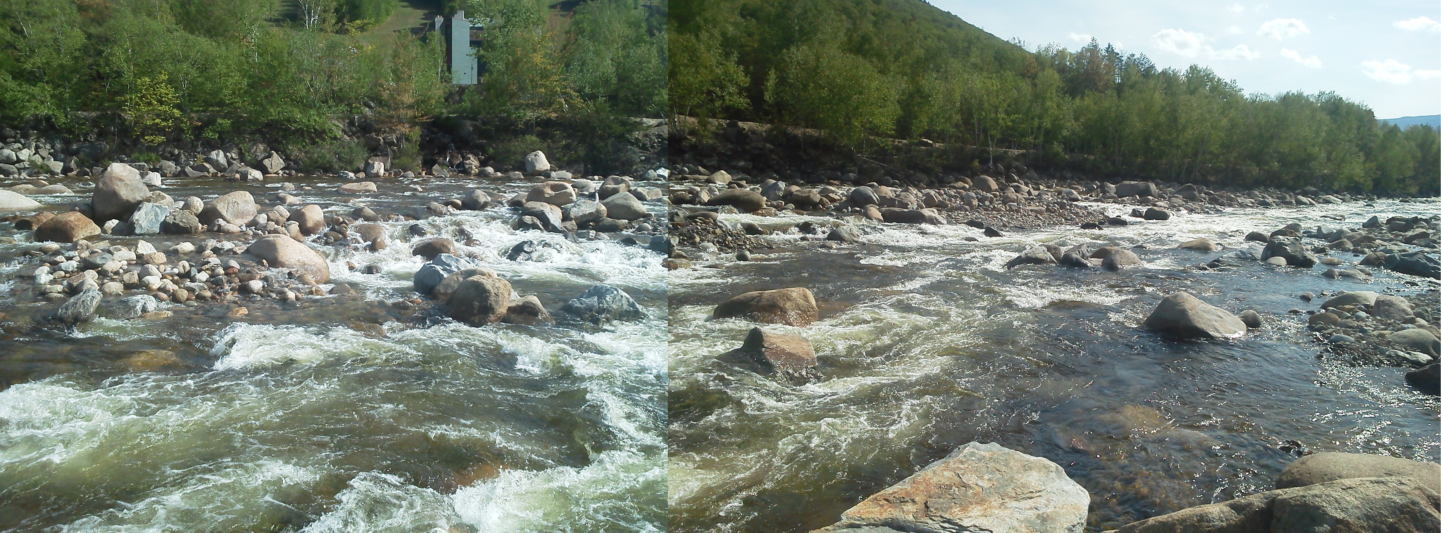
| 6. Over the course of a year-or-two the river punched a channel through the construction road and debris on river-right; opening up a new enjoyable route down thru the rapid which we were able to enjoy for a few years. For the years immediately previous, the only path down the rapid was on river-left which ended up in a rocky sieve where the two channels joined. Here I'm in the center of the new channel directly under the old bridge. (The rusty bridge abutment cover is just aft of my stern.) Photo July 5, 2015 © Dave Hogan. River level 700 cfs during a rare early-summer run. |
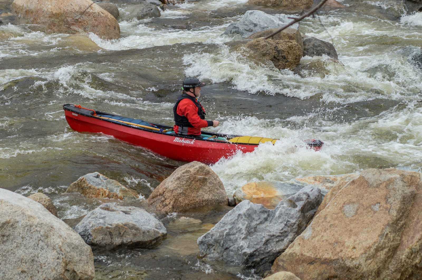
| 7. Below this new channel in the construction road the rest of the original river-right channel was mostly unchanged. A sporty, but uncomplicated straight shot down to the end of the rapid. Photo May 3, 2014 © Justin Borden. River level 760 cfs. |
| 8. Along the right channel it was narrowed slightly with rocks piled along the river edge (to prevent erosion of the road I guess). Photo July 7, 2017. |
| 9. Originally this area was a steap sporty class IV route below the initial main drop. There were three or four challenging routes thru here. This photo the second in sequence of the one above in May 2001. One major challenge was attempting to maintain control while building up a huge velocity going down the steep gradient. |
| 10. This area is now completely smooth with the gradient flattened out and large rocks removed, resulting in a flat river bottom reducing overall speed, waves, and need to maneuver. Photo May 23, 2017, river @480cfs. |
| 11. A closeup of the left run down the right channel taken May 3, 2009 (level about 875 cfs). This was post-Irene, but before the major changes to the rapid. The route was very pushy and technical requiring quick maneuvering. |
| 12. Today (photo 23-May-2017, level 480cfs), the rocks are gone except for the biggest one dividing the river into the two channels. |
| 13. Below the big rock a cross-channel has been opened by the river going from the left channel to the right. |
| 14. Below the rapid a new one has appeared, apparently containing some of the missing rocks from upstream. |
|
There has been some speculation that the river may make more changes
over the years, however given the now lack of gradient under the bridge
it may not change that much. I'd expect more changes to occur in the
newer rapid below the former Loon Mountain Rapid.
Loon Mountain Rapid, we knew you well. R.I.P. |